
Recent Projects
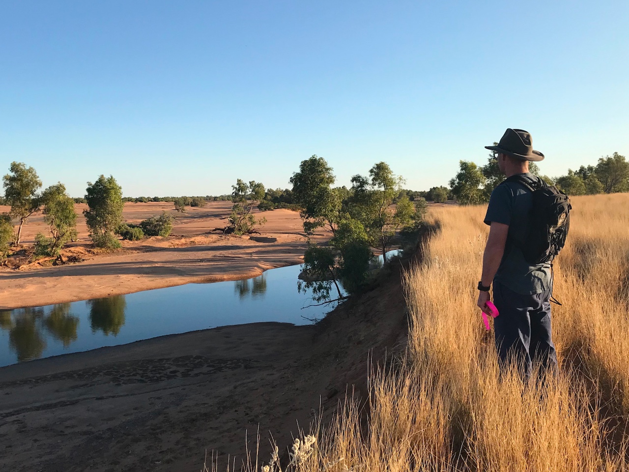
Ecological Water Requirement Study for the Shaw River target area
Client: CSIRO
Stream worked with CSIRO to conduct an ecological water requirements (EWR) study of the Shaw River target area as part of the DPIRD Transforming Agriculture Pilbara (TAP) project. The study included:
- Identification of potentially groundwater dependent ecosystems (GDEs) and other riverine ecosystems.
- Development of conceptual models to characterise the link between the identified ecosystems and groundwater and/or surface water regimes.
- Confirmation of conservation values/status of GDEs and riverine ecosystems within the target areas.
- Determination/assessment of EWRs for the GDEs and riverine ecosystems to inform potential water resource management in the target areas.
To verify GDE and riverine ecosystem composition and conservation values, the following tasks were carried out:
- Mapping and description of groundwater dependent and riparian vegetation communities using remote sensing analysis and ground truthing.
- Assessment of the condition of groundwater dependent and riparian vegetation communities.
- Established representative sites to support the determination of EWR's.
- Assessment of river pool condition (including water quality monitoring and aquatic habitat).
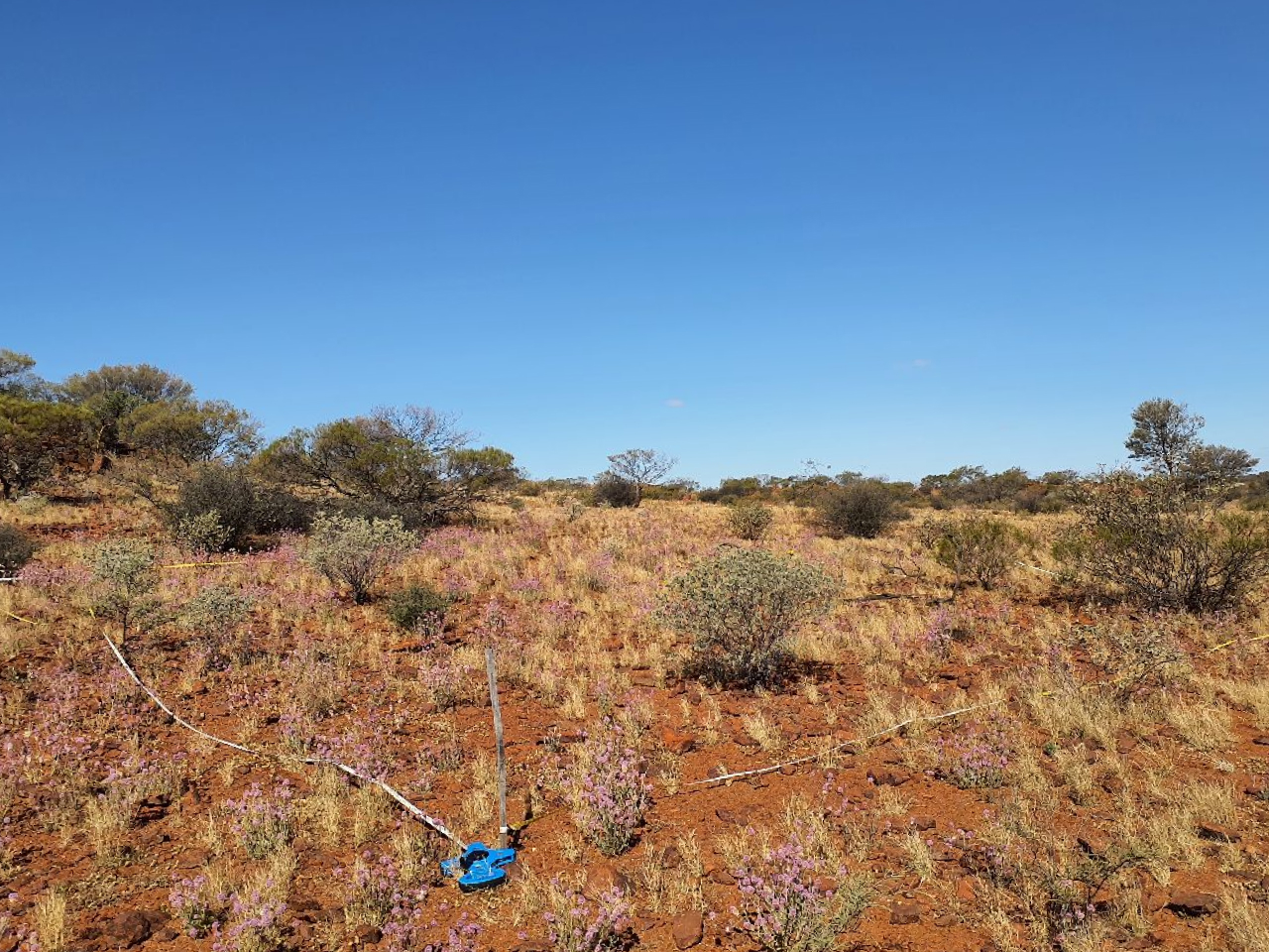
Cosmos Rehabilitation Monitoring Program
Client: Mine Earth/IGO
Stream was contracted to develop a revised rehabilitation monitoring program as a component of the mine closure plan for the IGO Cosmos Project. Our involvement included:
- Review of previous monitoring and criteria in the mine closure plan.
- Development of an appropriate monitoring approach to allow assessment against completion criteria for rehabilitated landforms.
On site our tasks included:
- Establish monitoring sites.
- Conduct monitoring of rehabilitated landforms and analogue sites.
Following the field component we:
- Analysed the monitoring outcomes and assessed results against completion criteria.
- Summarised the details of the monitoring program including the methodology and results in a report.
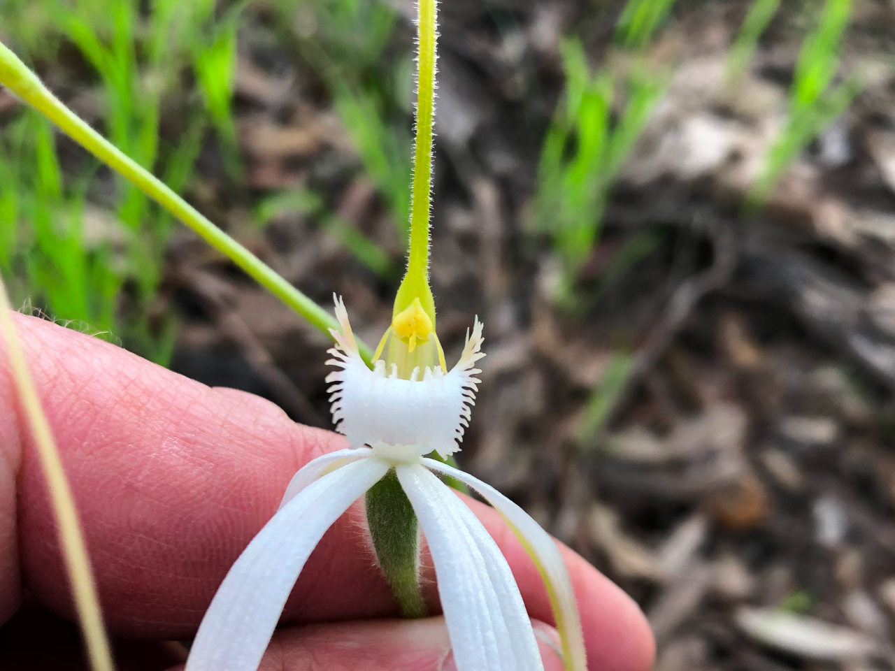
Donnybrook-Kojonup Road Flora and Vegetation Survey
Client: Main Roads Western Australia
Stream was commissioned by Main Roads Western Australia to undertake a reconnaissance and targeted flora and vegetation survey along a section of the Donnybrook Kojonup Road. The survey included:
- A desktop assessment to review the flora and vegetation values likely to be present.
- A spring flora and vegetation field survey.
- Statistical analysis of data from quadrats surveyed to assess potential alignment with TECs found within the survey area.
The survey area supported some significant flora and vegetation values which were summarized in a flora and vegetation report. The field survey found that native vegetation covered slightly less than half of the survey area. However, there were some areas of native vegetation in good condition and conservation significant flora and vegetation values included:
- Populations of two Priority flora species, Hydrocotyle lemnoides (P4) and Ornduffia submersa (P4) and collection of Pimelea imbricata var. major representing a south-easterly range extension for this taxon.
- Confirmation that the occurrence of a claypan vegetation unit as representative of the EPBC listed 'Claypans of the Swan Coastal Plain' TEC, of which the state listed 'Clay pans with mid dense shrublands of Melaleuca lateritia over herbs' PEC is a sub unit.
The assessment of the claypan community included Floristic Community Type (FCT) analysis and consideration the description of the claypan ecological community in relevant literature. The occurrence of the claypan within the survey area was in excellent condition and provided habitat for the two priority flora species.
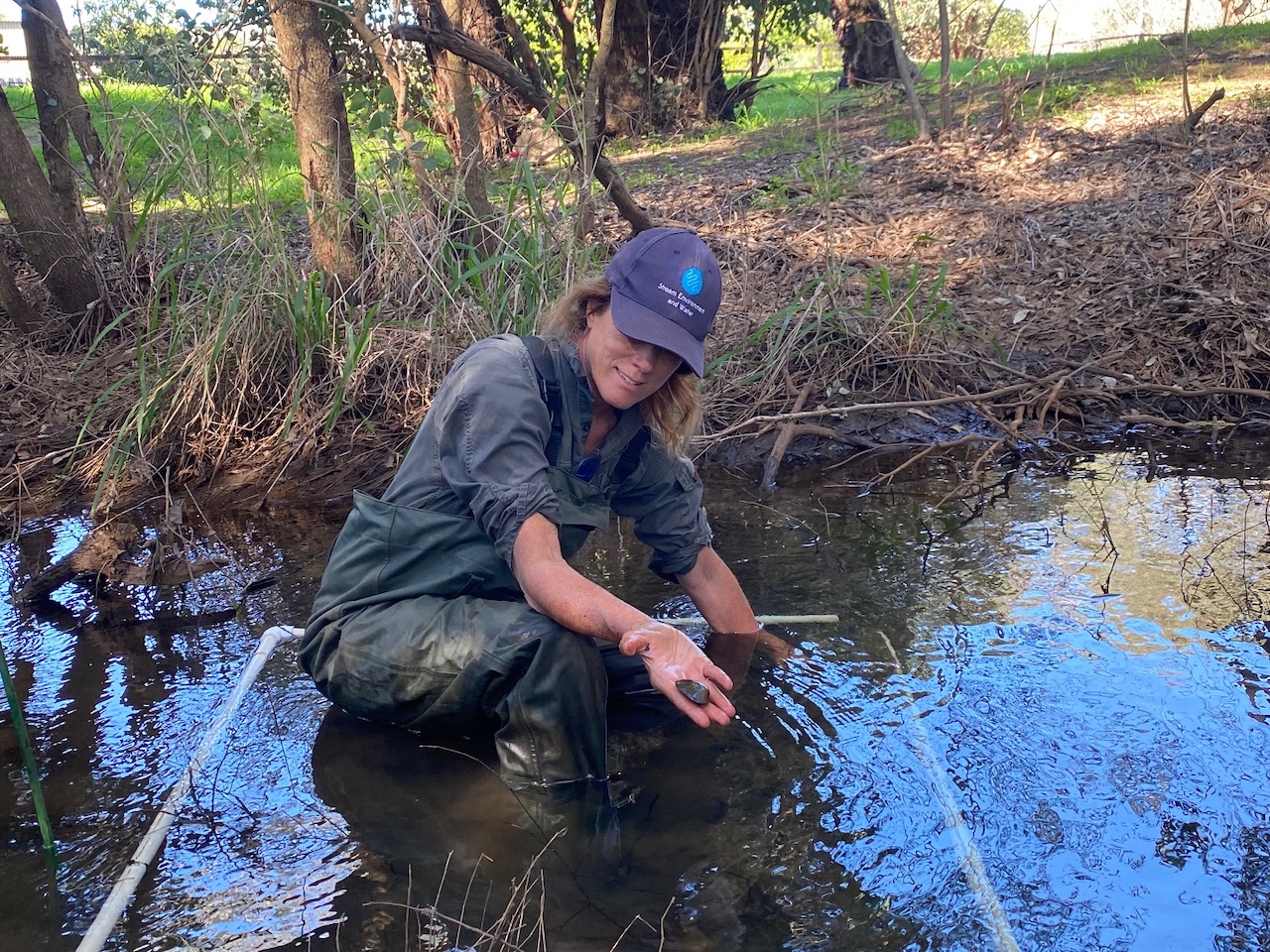
Carter's Freshwater Mussel Survey Southwest Rivers
Client: Main Roads Western Australia
Stream conducted a targeted fauna survey for Carter's Freshwater Mussel ( Westralunio carteri ) in bridge sites where the Bussell Highway crosses the Abba, Ludlow and Sabina Rivers. W. carteri is the only native freshwater mussel found in south-western Australia and is currently listed as Vulnerable on state (Biodiversity Conservation Act 2016), national (Environment Protection and Biodiversity Conservation Act 1999) and international conservation lists (ICUN Redlist (ICUN 2020)).
- We completed a desktop review to determine whether there were previous records of the mussel in or near the survey areas and identify suitable habitats within the survey areas.
-
A targeted field survey for
W. carteri
was completed for each bridge site and included the
following tasks:
- Habitat Assessment (i.e. river physical form, substrate, riparian vegetation etc).
- Water quality assessment where surface water was present.
- Targeted searches for Carter's Freshwater Mussel where suitable habitat was found.
- A technical report was prepared for Main Roads detailing the results of the targeted fauna survey.